
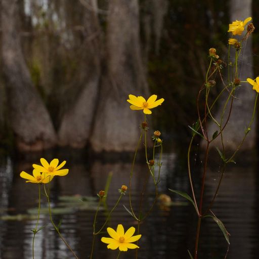
As a National Wildlife Refuge, the Okefenokee Swamp is protected specifically for its value in supporting and maintaining the populations of America’s wildlife and their habitats. A Comprehensive Conservation Plan created for the refuge reviews its conservation needs and major threats, setting out a strategy for preserving it. The swamp is also classified as a wilderness area, the highest form of protection of any federal wildland. These protections signify that the ecosystems and natural features within the boundaries are to be preserved for the future, with no commercial enterprise or development. A major focus of wilderness areas according to The Wilderness Act of 1964 is to protect endangered and threatened species, and to preserve the untouched “wilderness character” of the region.
Unfortunately, many of the Okefenokee’s greatest threats come from the surrounding, adjacent areas of land, which have no form of protection. Changes in the surrounding landscape have been accelerating in recent decades, with commercial and residential development, as well as intensifying agriculture and replacing forestry lands. Because these lands are primarily privately owned, rapid turnover in management has occurred with little consideration or understanding of how these changes might affect the swamp.
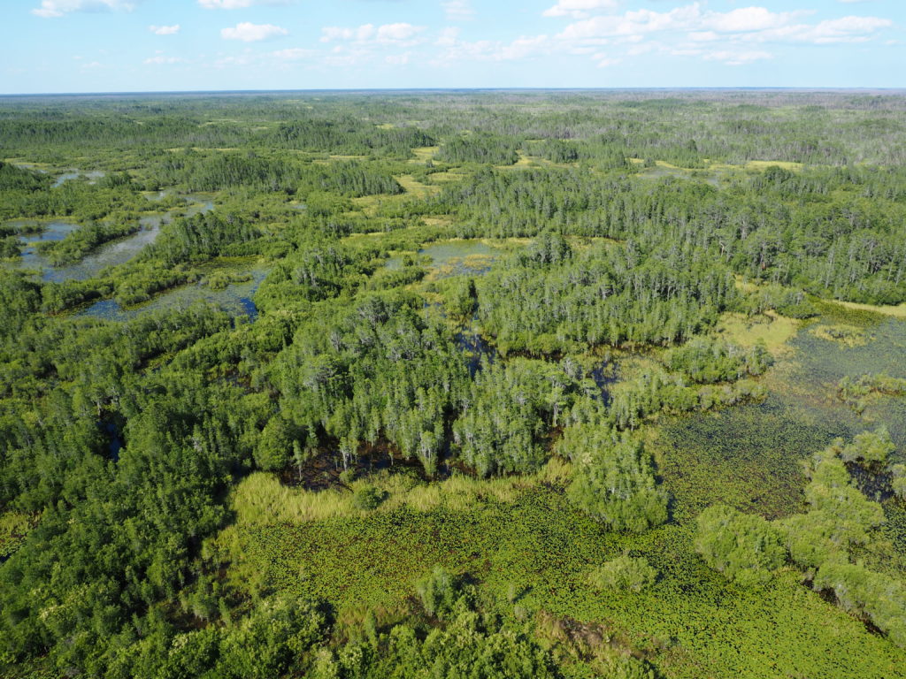
Since water is the Okefenokee’s lifeblood, these changes could have damaging impacts over time. Shifts in land use around the swamp have increased the rate at which water leaves the swamp, primarily through groundwater drainage. As a National Wildlife Refuge and wilderness area the Okefenokee’s waters are protected from being extracted within its boundaries, those waters are connected underground to groundwater in the surrounding area. As those are used up, water from inside the refuge flows outward and is drained. Combined with higher levels of groundwater removal for agricultural, commercial, and residential purposes, increased water use and landscape change are lowering the water table of the Okefenokee, negatively affecting plant and wildlife habitat. Reductions in the amount of water on the Okefenokee landscape also changes the patterns of wildfires, which can negatively impact habitats.

The intensification of economic activity and land use around the refuge has also degraded water quality in the swamp. While sediments and nitrates entered the Okefenokee’s waters because of surrounding forestry processes, the amount of these pollutants has increased with more agricultural, residential and commercial land uses. These types of land cover contribute stormwater runoff that contains heavy metals, fertilizers, herbicides, and pharmaceuticals. Some pollutants suspended in the atmosphere from coal power plants and automotive use are also deposited regularly in the Okefenokee’s water. These pollutants can harm wildlife and change habitats by favoring certain species of vegetation over others. Mining operations have the dual impact of increasing water contamination with a variety of pollutants and changing the drainage of the landscape around the Okefenokee, impacting water quality and quantity.
These impacts are particularly troubling because they synergize or combine with many of the effects of climate change. Observations and predictions for climate impacts on the Okefenokee indicate that the swamp will be receiving less water and experiencing increased frequency and intensity of wildfires. More wildfires and less water could impact the goals of the Okefenokee’s protected status. Specifically, these threats could change the natural character of the swamp and reduce its ability to support important wildlife.
Threats to the Swamp Ecosystem
Mineral sand mining on Trail Ridge east of the swamp is a potential threat to swamp hydrology and ecology.
Many of the old barrier island features of the Atlantic Coastal Plain, including Trail Ridge, contain relatively high fractions (1.5-5%) of titanium or mineral sands. More than 2% is considered commercially valuable. These are dark, relatively dense sands containing commercially-valuable levels of titanium, zircons, and rare earth elements. These mineral sands are mined by removing all of the sands from pits that are typically 10-20 meters deep, extracting the mineral sands from the non-mineral sands, and putting the non-mineral sands back in the pit. The pits move back and forth across the mining area until all the sands have been mined, and approximately 95-98% of the sands are returned. Ideally, the mine site is “reclaimed” by restoring the topsoils and grading the site to approximately its original topography. Mineral sand mining of these old barrier islands has been common in Florida and Georgia, and much of the Florida section of Trail Ridge below Interstate 10 has been mined since the late 1940s.
Restoring the pre-mining soils, vegetation, and ecology of these sand ridges is difficult. These ridges typically feature a relatively high density of depressional wetlands and ill-defined intermittently-flowing drainage swales that provide wetland habitat for plants, insects, birds, amphibians, and reptiles. They also feature thin topsoils with high organic matter content. Most of the nutrient cycling for the forests that grow on these ridges takes place in these thin topsoils. Restoring these topsoils, depressional wetlands, and drainage swales is difficult, and some of the previously-mined portions of Trail Ridge in Florida show difficulty with forest regeneration and growth.
Mineral sand mining on Trail Ridge east of the swamp could affect the hydrology, drought frequency, and ecology of the swamp in several possible ways. First, continuous pumping of superficial aquifer water is necessary to keep the mine pits nearly dry. This pumping would remove water that would otherwise flow to the swamp. Second, the mines have to pump clean operations water from the Floridan aquifer below the swamp, increasing the rate of leakage from the swamp to the Floridan aquifer. Third, the mixed sands returned to the pits would move water faster than the layered sands removed from the pits, and this would increase the lateral flow eastward through Trail Ridge. All of these hydrologic changes would make the southeastern portion of the swamp more sensitive to drought. Droughts, which are natural in the swamp, would become more frequent and severe.
Mining operations have been proposed on Trail Ridge east of the swamp in the past. In the 1990s, the Dupont corporation proposed a very large Trail Ridge mine (38,000 acres). This proposal generated widespread opposition from the grassroots level up to the Secretary of the Interior, Bruce Babbitt, and Dupont eventually abandoned its plan. Dupont donated 16,000 acres to the Conservation Fund and sold the rest back to timber interests.
In 2018, Twin Pines LLC proposed a plan to conduct phased mining on Trail Ridge, starting a years-long permitting process. That proposal ended in 2025, when The Conservation Fund purchased the land and mineral rights for $60 million. See the timeline of that proposal here.
However, mineral rights are still available to the north of the TPM LLC site, so there is the potential for new mining proposals in that area. Protecting Trail Ridge from mining remains a conservation goal for the Refuge and many environmentalists in the state.
To learn more about the Okefenokee National Wildlife Refuge and Twin Pines Mine, read FAQs from the US Fish & Wildlife Service.
Quick Links