GEORGIA-XH-CW
Search
Close this search box.

Altamaha

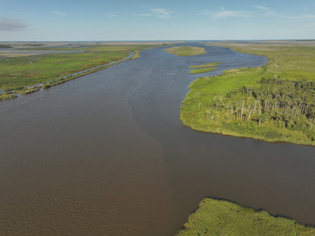
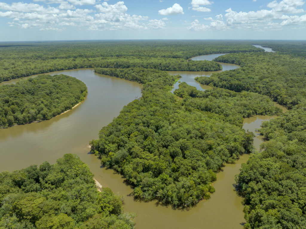
The Altamaha River is the largest river in southeast Georgia, flowing from the confluence of the Oconee and the Ocmulgee for about 137 miles before draining into the ocean near Brunswick, GA. Although the full Altamaha Basin encompasses the Ocmulgee and the Oconee Basins, the lower Altamaha and its tributary, the Ohoopee, are largely undeveloped and among the most intact rivers in Georgia. The name Altamaha comes from one of the three Indigenous chiefdoms of the Oconee River Valley area, and the basin lies on Muscogee (Creek) land. Continue exploring the Altamaha below.

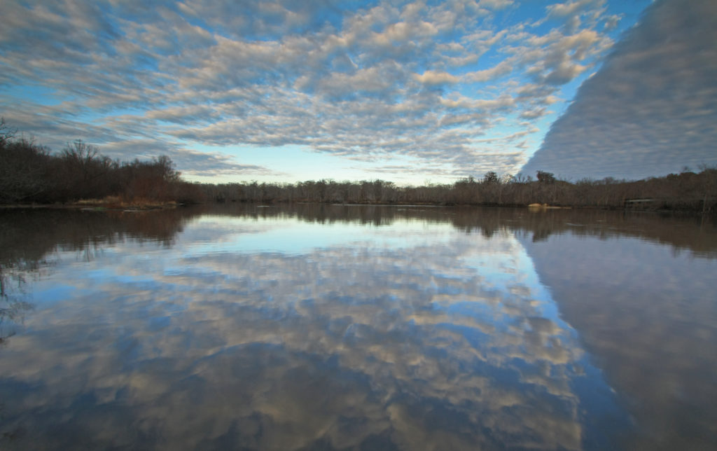
Photo by Alan Cressler via Flickr. Location: Altamaha River, cloud bank, at Altamaha Park, Glynn and McIntosh Counties, Georgia.

CONSERVATION

Learn more about the basin (including how you can get involved in its conservation) at Altamaha Riverkeeper.

Visit the South River Watershed Alliance, which works in both the Ocmulgee and Altamaha basins.

Explore USGS data logs from the Altamaha River monitoring location.

See EPD’s TMDL Reports for the Altamaha River Basin.

Learn about the EPD’s Fish Consumption Advisories online in the Guidelines for Eating Fish from Georgia’s Waters.

Photo by Alan Cressler via Flickr. Location: Altamaha River, Altamaha Wildlife Management Area, McIntosh County, Georgia.

RECREATION

Visit the Altamaha River Water Trail for a calm day on the water.

Explore Altamaha Wildlife Management Area/Altamaha Waterfowl Area, the second largest waterfowl area east of the Mississippi.

Other parks and recreation areas: Barrington County Park, Big Hammock Natural AreaLewis Island Natural AreaWolf Island National Refuge

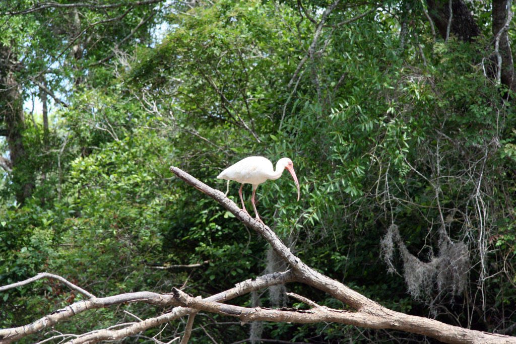
Photo by Alan Cressler via Flickr. Eudocimus albus (White Ibis) is a common shorebird of the Southeast and beyond. Location: Valentine Creek, Altamaha River, McIntosh County, Georgia.

EDUCATION

Learn more about the Altamaha, along with Georgia’s other amazing rivers, at Georgia Rivers.

Read about “The Allure of the Altamaha” at The Nature Conservancy.

Read about “the river nobody knows” (but everybody should) at Explore Georgia.

Explore Georgia State-Protected species by watershed at the Georgia Biodiversity Portal.


Photo by Alan Cressler via Flickr.

Map of the Lower Altamaha-Ohoopee River Basin. Created by Anna Baynes (UGA River Basin Center).